In Part 1, you read about our visit in and around Leh. Part 2 of this travelog series took you through Pangong and Nubra. In this installment, you'll accompany us out of Leh, through TsoMoriri and Tsokar, and into Keylong. And do check out the travel tips section at the end of the post.
Day 7: Friday, 23rd July – TsoMoriri
It was time to say good-bye to Leh. We checked out of our guest house at 8 am, bidding farewell to our hosts. Our route today took us on the Leh-Manali highway past Shay, Thiksay and Karu until Upshi, where we had to show our permits.
After Upshi, we branch off to the left, following the Indus river. We would be following the Indus river upstream for a good 3 hours. The roads are much better here, and you also see villages every 10-15 kms or so. There was a spot where a wooden bridge crossed a stream. We stopped here to collect drinking water and also to do some photography. It was a very beautiful spot where we could see a distant peak playing hide and seek with the clouds.

Our next stop was at Chumathang where there are hot springs. It is amazing to see the boiling water bubble out angrily from the ground. We wanted to bathe here but the bathroom facilities were rudimentary, at best. We had a mid-morning snack of Maggi noodles and then continued on our way. By noon, we were at Mahe bridge. We showed our permits here again. If you go straight (in a South-Easterly direction), you enter the restricted areas of Nyoma and Hanle. We turned right, crossed the bridge and headed South to TsoMoriri.
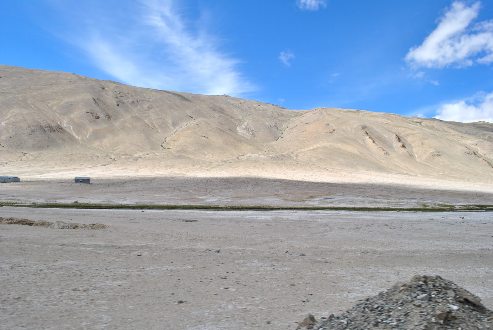
The roads were still excellent. They had a purplish tinge to at the sides. Must be the soil colour. We then ascended a very small pass and soon, a small lake came into view. This lake is named Thadsang Karu. It was covered with clouds just above its surface when we reached there. It would have made for an amazing photoshoot. But there was a very light drizzle, which brought in strong winds and the accompanying chill. Within 3 minutes, we were huddled back in our car. So much for photo-shoots!

We continued along Thadsang Karu, now on mud roads. 15 minutes later, Tso Moriri made an appearance on the horizon. Even then we had to drive for 45 minutes before we could reach our camp. At almost 3 pm, we checked in to the camp. Unlike the camp at Pangong, which was almost on the lake shore, this one is set up mid-way up a small hill overlooking the lake. There is also a village next to the campsite. Because of this, the feeling of isolation was missing here. The views, however, were as breath-taking as those at Pangong.


We first took a stroll to the lake, and then along it. Again, the experience of looking out at the indescribable colour combinations of the lake, the breeze blowing lightly, the mountains wherever you look up. We were actually annoyed when it was time time to return to camp!

Dinner was pretty early. When we were done with dinner, it wasn't completely dark yet. Just when we came out of the dining tent, we were treated with the sight of a near-full moon (maybe just 2 days shy of full moon). And the moon was casting a fluorescent tinge on TsoMoriri. It was an extraordinary sight. I rushed to get the tripod and set it up. For the next 15 minutes, we took turns trying to get long-exposure shots from the Nikon D3000 and the Canon Powershot S3IS. We did get a few good-looking ones at exposures of 15 seconds plus.


By now it was really cold. We were given those rubber bags filled with hot water, with a sheepskin pouch added to it. We wondered why they were going to such great lengths. We got the answer when we hit the sack. This was to be the coldest night of the trip. It was so damn chilly, that when we turned to one side of the bed, the other side would get freezing cold! This, in spite of multiple layers of clothing and multiple blankets and rugs.
Day 8: Sat, 24th July – TsoKar
We caught the sunrise bang outside our tent at 5:30. This time there were no clouds playing spoilsport. We had breakfast around 7:30 and left by 8. We retraced the mud track for an hour back till Thadsang Karu, where we hit the tar road. There were no clouds over this lake today and as such it seemed brighter. Less than an hour later, about some 15 kms before Mahe, is the deviation to the left which takes you west-ward to TsoKar.
The next 2 hours were yet another experience etched in my memory. It was a dirt road through a valley. We first saw the Puga hot springs in the distance – but did not stop. After that, we drove through deserted wilderness – with almost no sign of civilization whatsoever. It was almost as of we were the only humans left on Earth. We only had wild asses for company every 5-10 kms. This drive would easily qualify for Discovery Travel&Living channel's series “Journeys to the Ends of the Earth”.
Only past 11 am did we hit a metalled road and reached TsoKar village. We caught glimpses of the TsoKar lake now. We saw some white deposits and were excited that it might be snow. It turned out that the white patches were salt deposits. We learnt there that we had to cross the entire width of the valley to reach our camp. The valley here is one big pasture. It took us more than 15 minutes to cross the pasture and reach our camp.
The camp here is the largest of all that we had seen so far. Since we were too early for lunch, we just had a quick tea and drove to the lake. This is yet another 15 minute drive. Unlike Pangong or TsoMoriri, the camp at TsoKar is not right by the lake. Instead it is in a pasture some 3-4 kms away. When we reached the lake, we could see why.
The salt deposits raise a stink which seems okay at the beginning but which turns unbearable after you spend some time there. Needless to say, our photo session here was very short. We got the only snap of all 4 of us (the fourth person being Trashi) and then returned to camp.


Lunch was ready when we returned, a heavy lunch at that. That necessitated a good rest before we set off to explore. This place was already very windy – that gave us an indication of things to come at night. We saw quite a lot of birds some distance from our camp. I tried to capture some snaps unsuccessfully. Santhu had a better idea. He used some dry fruits as a bait. He had to wait almost an hour before the birds took his bait – but hats off to his perseverance, he got some amazing snaps.
We then set out to do some walking. We got some snaps of horses grazing in the pasture but these snaps were overexposed. We walked towards the lake, hoping to reach it in an hour. By this time there were lot of foreigners who had arrived at our camp and they too had started trekking towards the lake in 3-4groups.
45 minutes later, we weren't even half-way to the lake, and decided to return. Some of the foreigners continued while others did a U-turn as well. On the way back, I again photographed the horses and did a better job of it this time. We met a Belgian family that was camping in their own tent nearby. I had a discussion with the father about our cameras and lenses and stuff. It was nearing 6:30 when we returned to camp.


As soon as the sun set, the wind picked up speed. The wind was strongest here and we had this nagging fear that the tent might fly away. After dinner we sat for some time outside our tent but the sound of the wind flapping against the tent was irritating. We decided to go for a post dinner walk. That was another great experience. Here we were, walking at night from the middle of nowhere, to the middle of nowhere. We were back in our tent a half hour later, and ready for a good night's sleep.
Day 9: Sun, 25th July: TsoKar-Keylong.
The original plan was to stay at Sarchu today and leave for Manali the next day. However, Sarchu-Manali is a long drive and we had heard that Rohtang pass was not in a good shape. So we wanted to get as close to Manali as possible on this day itself. So we decided to try and reach Keylong instead. For that we had to depart as early as possible.
We woke up at 5:30, and getting to the common bath area was an effort in itself. Uh, didn't I mention that the bath and toilet is not attached here in TsoKar? It is just some 20 yards from the tent but like I said, it was cold, the water was cold. Washing your face and brushing in this cold water – that is something you're not going to forget in a hurry.
Mercifully, tea and breakfast was piping hot. We were on our way by 7 am. Just beyond our camp, we came across more Marmots but couldn't get any snaps. We headed west from our camp in the dirt roads in the pasture. 10 minutes later, we hit the Leh-Manali highway. Here, we took a left to head South. Soon, we were driving through the Morey plains which is a stretch of some half an hour of flat roads. However, there was lot of bridge construction going one here which forced us to drive off the road and in the dirt again. We could see large herds of Pashmina sheep grazing in the plains but couldn't get close enough to get good photos.


At the end of the plains, we got an awesome view of a river down in the valley. The map doesn't name this river but shows that it originates in (or flows to) TsoMoriri. By 8:30 we were in Pang, where we stopped for tea before continuing. From Pang, we started uphill and around 10 we were at LachulungLa pass. After this was one more of the numerous landmarks on Leh-Manali road: the Gata loops. This is a series of 21 hairpin bends that brings you down from an elevation of ~4650m to ~4100m in a span of ~7kms. Of course, we got some snaps here. We weren't going to let such an opportunity pass, were we?


Just after 11, we reached Sarchu. Here we stopped for an early lunch, and resumed at 11:30. Sarchu is the border between J&K and HP. So we were officially saying good-bye to Ladakh and entering Himachal Pradesh here. We felt a pang of sadness at this point. We had to bid farewell to a land that we had all unconditionally fallen in love with, and spent 9 days in.
So, in HP, the first half hour was fairly flat. There was a road block for about 20 minutes at one point where there was a bulldozer engaged in some work related to road widening. Once the block was cleared, we started ascending up BaralachLa. This pass looked like, as Sandy put it, mother nature had donned a Zebra-patterned veil. It was all black mountain face or white snow. Just after BaralachaLa is SurajTaal – which is a small, very pretty, high altitude lake.


The road condition improves a lot after here. Quite a few stretches are almost 2 lane wide with smooth riding surface. Road widening is going on in several other stretches. We passed by yet another picturesque small lake named DeepakTal where there was boating. We did not go boating though. Just clicked a couple of snaps and we were on our way.
Around quarter to 3, we reached Darcha, where we stopped for snacks. There on, it was an hour's drive to Keylong. The landscape changes drastically here. The terrain is similar to Ladakh but it is all green everywhere. There are more villages, more people. We checked into Hotel ChanderBhaga in Keylong around 4 pm. The first thing we did was have leisurely baths. Remember we had no access to hot water since the time we had left Leh more than 2 and half days back. You don't want to know how unwashed we looked and felt.


After bath, we went for a walking tour of the .. well.. town. Keylong is more than a village – it has a proper bus stand, several restaurants and hotels, a BSNL tower and telephone exchange. For the first time since we had left Leh, we were within range of Airtel network. So, yes, we toured the town, and on our way back, clicked snaps at a spot where dozens of vehicles were being washed in a stream which crosses the road.
It was dark when we returned to the hotel. After dinner, we spent a lot of time in front of the TV. We had forgotten what it is like to watch TV! We also had to say an emotional good-bye to Trashi now. Since the road between Keylong and Manali is very bad, and there were a couple of problem points, Trashi did not want to risk any damage to his brand new Innova. He arranged for a Tata Sumo to take us to Manali the next day. He would start at 5 am next day and aim to reach Leh the same evening.
The next part of this series will be the concluding part. So do come back.
Travel Tips
- We think it is not really necessary to camp at both TsoMoriri and TsoKar. A better idea would be to leave very early from Leh (by 6 am), reach TsoMoriri by noon, spend a couple of hours there, and then reach TsoKar the same evening to camp there. This is pretty doable.
- Remember there's no hot water facility in any of the camps. If you do camp at TsoMoriri, then you could use the hot water that they provide in the pouches. It is sufficient for a bath if you use it at night when they give it to you. By morning, it would have become lukewarm.
- We again sorely missed having a wide angle lens at TsoMoriri.
- Don't miss the opportunity to photograph the wildlife in the pastures – even if it means a detour. Especially Wild asses.
- There are several stay options on Leh-Manali highway. Most are camps though (Sarchu, Darcha). Proper hotels are available at Keylong and Jispa. Remember that camps are generally much more expensive than hotels.
- If you are driving yourself, remember to tank up at Leh and also store extra fuel in cans. You aren't going to find any pumps until Tandi (which is 20 kms beyond Keylong).
- Night travel is strongly discouraged since if you are in a spot, then chances if finding help are very slim.
- Some camps do not have power outlets in the tents – so charging your mobile phones and camera batteries might not be possible. Conserve the power – switch off your cellphones as soon as you exit Leh. You are not going to need them until you reach Keylong – unless you have a BSNL connection.
2 comments:
Kiran bhai, awesome, I am becoming a great fan of your travelogues.
A very good write up. I want to go & spend a night at Pangong lake. Looks hard but I'm holding on to my dream. but whenever the time will come, I will go through the saved notes of your log.
Post a Comment